Darren's Rides
Arizona’s Outdoor News
Arizona Small Town Fire Stations
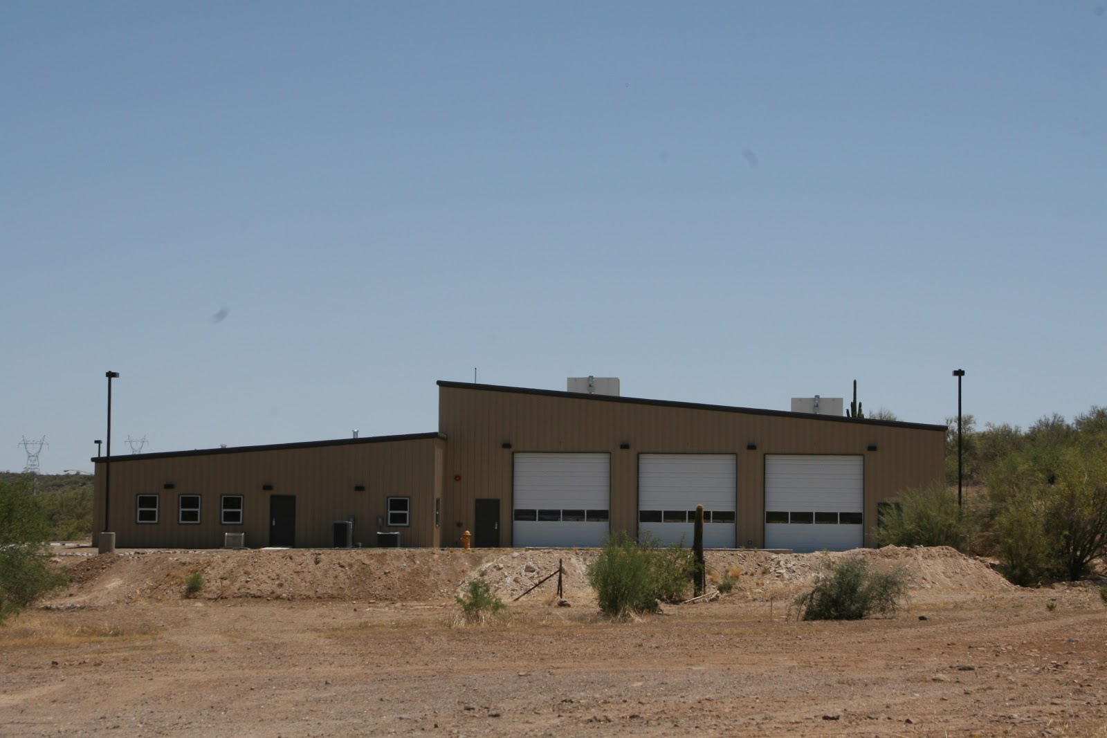
Black Canyon Fire District
Black Canyon City Arizona
San Bernardino California on the Parker Arizona Strip
Parker Strip Arizona
Lake Havasu City Fire Station
Lake Havasu City Arizona
McMullen Valley Fire
Salome, Arizona
Golden Shores Fire
Topock, AZ
Seligman Fire
Seligman Az
Marine Corps Air Station Yuma Fire Department
Yuma Az
Jerome Volunteer Fire Department
Jerome Az
CRIT Fire Department
Colorado River Indian Tribes (CRIT) Az
Parker Fire Department
Parker Az
Aguila Volunteer Fire Department
Aguila Arizona
Oatman
Fire Department
Oatman, Arizona
911 Flags Arizona
Miami Fire Department
Miami Arizona
Joseph City Fire Department
Joseph City Arizona
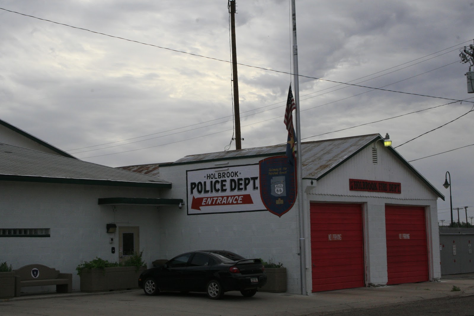
Holbrook Fire Department
Holbrook Arizona
Holbrook Volunteer Fire Department
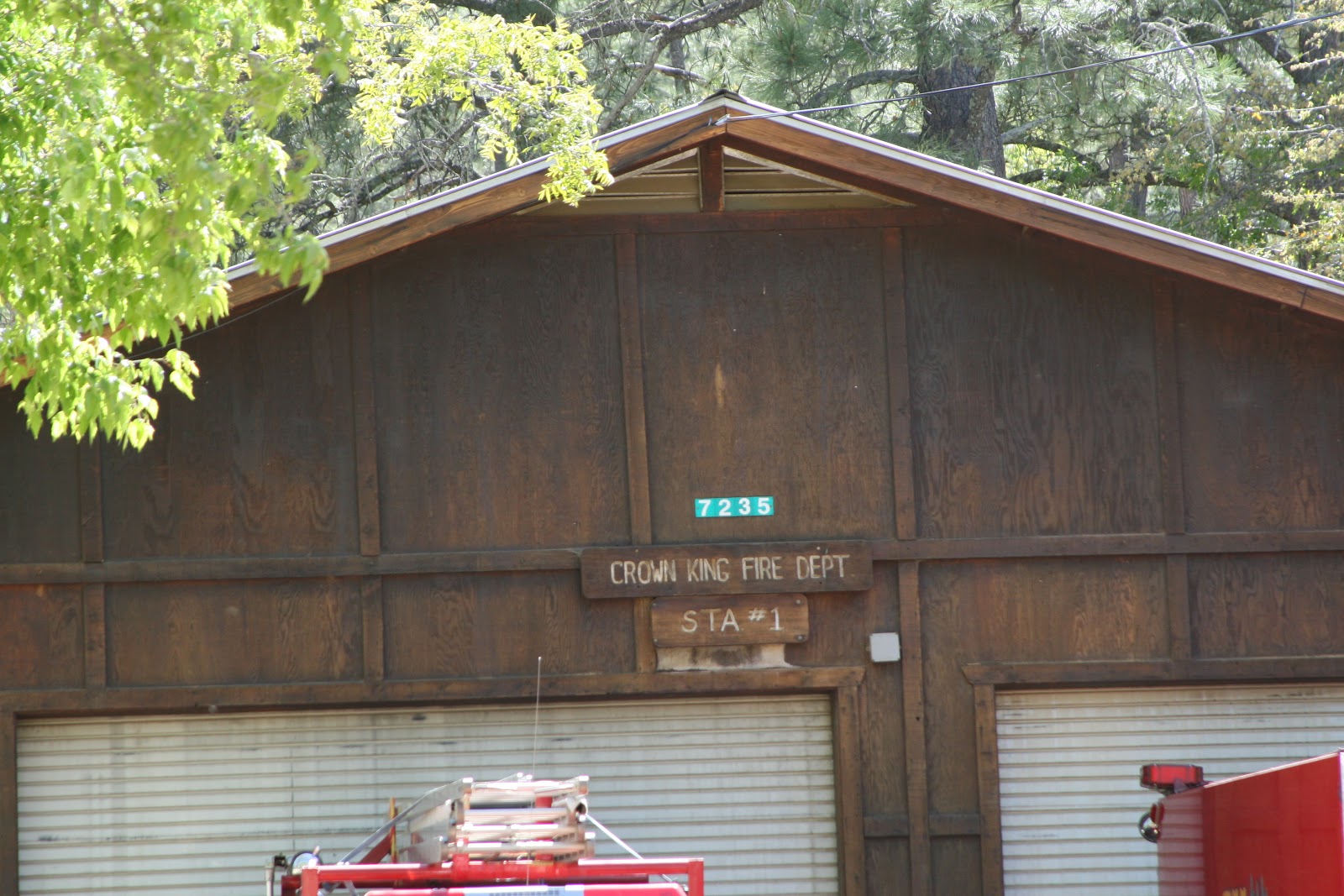
Crown King Fire Department
Crown King Arizona
Sedona Fire
Sedona Arizona
Mayer Fire Department
.
Cordes Junction Arizona
Nogales Fire Department
Nogales Arizona
Patagonia Volunteer Fire and Rescue
Patagonia Arizona
Sonoita-Elgin Fire Department
Sonoita, AZ
Huachuca City Fire Department
Huachuca City
Whetstone Fire District
Whetstone, AZ
Kearny Fire Station
Kearny Arizona
Hayden Volunteer Fire Station #1
Hayden Arizona
Dudleyville Volunteer Fire Station
Dudleyville Arizona
Mammoth Volunteer Fire Station
Mammoth Arizona
You +1'd this publicly.
Undo
Winkelman Volunteer Fire Station
Winkelman Arizona
Older Posts
Home
Subscribe to:
Posts (Atom)
Darren's Rides
Darren's Rides
Darrensrides
View my complete profile
Other Darren's Rides Links
Darren's Rides Flickr Photo's
Darren's Rides You Tube Video's
Search This Blog
Blog Archive
▼
2015
(1)
▼
April
(1)
Arizona Small Town Fire Stations
►
2013
(1)
►
March
(1)
►
2012
(4)
►
October
(1)
►
September
(1)
►
March
(1)
►
February
(1)
►
2011
(44)
►
December
(4)
►
November
(4)
►
September
(3)
►
July
(1)
►
June
(2)
►
May
(3)
►
April
(6)
►
March
(2)
►
February
(8)
►
January
(11)
►
2010
(62)
►
December
(1)
►
November
(9)
►
October
(13)
►
July
(5)
►
June
(4)
►
May
(12)
►
April
(2)
►
March
(6)
►
February
(5)
►
January
(5)
►
2009
(56)
►
December
(4)
►
November
(9)
►
October
(4)
►
September
(16)
►
August
(11)
►
July
(8)
►
June
(4)
What's Happening In Arizona
Active's Arizona Race Results
Active.com Events
Arizona Mountain Bike Race
Arizona Snowbowl Calendar
Arizona State Park Event Calendar
BetterRide Mountain Bike School
Bike Reg
City of Phoenix Parks Events
Dawn to Dust Mountain Bike Club Events
DCB Adventures Events
Desert Foothills Land Trust
Epic Rides Events
Flagstaff Biking Events
Get Set AZ
GO Adventures & Recreation
IMBA Trail Care Crew Schedule
Maricopa County Parks Events
Mountain Bike Adventures
Mountain Bike Association of Arizona
Mountain Bike Heaven Club Rides Wednesday, Friday & Sunday Mornings
Southwest Bicycles Cycling Club
The Nature Conservancy Events
Urban Assault Rides
Verde Valley Cyclists Rides
Volunteers for Outdoor Arizona
Trail Maps
Black Canyon Trail Maps
California Trail Maps
Cave Creek Regional Park
Fin's Trail
Flagstaff Trail Maps
MaricopaTrail Anthem to Spur Cross Park
McDowell Mountain Regional Park
McDowell Sonoran Trail Map
Mountain Biking Activities
Mt Graham Trail Maps
Payson Az Trail Maps
Phoenix Area Trail Maps
Sedona Trail Maps
Sedona Trails Map
Spur Cross Ranch Conservation Area
The Crook Trail
Tour De Scottsdale 70 Mile Road Course
Trail Maps Around Arizona
Tucson Trail maps
Verde River Sheep Bridge
White Mountians Trail Maps
White Tank Mountain Regional Park
Windgate Pass Trail
Other Blogs
denise's blog
McDowell Sonoran Preserve Blog
Swimming Pool Maintenance in the Sonoran Desert
My Flickr
Arizona Sliding Door
Mountain Bike Association of Arizona
Burn The Night
Hand Built
Better Ride's
SWB
Best in Sedona
Bike Reviews.Com
Cycling News
Cheapest Deals
Biking.Com
League of American Bicyclists
Mike Hites Photography
JaboPhotos
The Best Solutions
Every Link I Can Thing Of
3 Feet 2 Pass
Absolute Bikes
Agua Fria National Monument
Alison Dunlap Adventure Camp
American Diabetes Association
American Trails
Americorps
Angel Fired Pizza
Arcosanti Project
Arizona Bike Law Blog
Arizona Highways
Arizona Horse Lovers Park
Arizona Outdoor Travel Club
Arizona Sliding Door
Arizona Snowbowl
Arizona Snowbowl Lodge
Arizona Trail
Az Trail Build
Best Bike Buy's Search's
BetterRide Mountain Bike School
Bike & Bean
Bikes Belong
Biking.Com
Black Canyon Trail
Black Mesa Coal Train
Cabela's Out Door Gear
Camelbak
Cameron Suspension Bridge
Cameron Trading Post & lodging
Canada Bicycle Parts
Cane Creek
Cannondale Bikes
Castle Creek Winery
Castle Creek Winery
Chris King
City Center Of City North
Classical Music Archives
Clif Bar
Coalition of Arizona Bicyclists
Coconino Cycles Custom Hand Built Bicycles
Coconino Rural Environment Corps
coghlans
DCB Adventures
Dead Horse Point Utah State Park
Defenders of Wildlife
DIRT RAG
Drunk Cyclist
EDCDepot
Electra Bike
Epic Rides
Essential Gear
Exhale Bikes
Fat Tire Bike Shop Sedona Az
Federal Highway Administration (FHWA)
Flagstaff Az Daily News
Flagstaff Az Web Cam
FLAGSTAFF BIKING ORG.
Flagstaff Loop Trail Map
Forestry Tool Suppliers
Fox
Friends of the Forest Sedona
Giant Bicycles
Hans Rey Latest adventures
Hawley
Hike Arizona Maps
Hike Bike & Run
Hole N" The Rock
How to Disassemble an Edge
IMBA
Jagwire
JENSON USA
Justins Nut Butter
k-bars
KALI Protective
League of American Bicyclists
League of American Bicyclists
Maricopa Association of governments
Maricopa County Mountain Parks Annual Pass
Maricopa County Parks
MAVIC
MAXXIS
McDowell Sonoran Interactive Map
Mexican Hat Rock
Mike Hites Photography
Moab Adventure
Moab Biking Trails
Moab Skyway
Moab Uranium Tailings
Moab's Scenic Byways
MONUMENT VALLEY NAVAJO TRIBAL PARK
Moots
MOUNTAIN BIKE ADVENTURES
Mountain Bike Association Arizona
Mountain Bike Bill
Mountain Bike Heaven
Mountain Project
MTB RACE NEWS .COM
N-Power Peg
National Electronic Injury Surveillance System
National Highway Traffic Safety Administration (NHTSA)
National Outdoor Leadership School
National Parks of Canada
National Trails Training Partnership
National Weather
Nature & Rocks
Nissan Titan
NITE RIDER LIGHTS
NOAH Or Neighborhood Outreach Action for Health
Nutrition Data
outdoor recreational Insurance
PARK TOOLS
Payson Arizona Area Trails
Phoenix Parks and Recreation
Phoenix Parks Trail Map
Phoenix Zoo
Photography By April
Piestewa Peak/Dreamy Draw Trail Guide
Pima Trails Association
Poison Spider Bicycles
Porcupine Shuttle
Prescott National Forest
Press Coffee Food Wine
Professional Trailbuilders Association (PTBA)
Quality Bicycle Products (QBP)
R U Nuts Adventures
RACEFACE
Reach 11
Red Agave Resorts Sedona Az
Red Rock Ranger District
REI
RockGardn Body Armor
ROCKY MOUNTAIN BIKES
Rocky Mountain Research Station
safety equipment
Saris Cycling Group
Scottsdale Az
Scottsdale Healthcare
Search For Felons in your area
Sedona AZ
Sedona Trail Map
Singletrack Maps
Six six One
SLIME
Snakes of Arizona
Sonoran Desert Mountain Bicyclists
South West Bicycles
Southern Off-Road Bicycle Association (SORBA)
Specialized
Sportsman's Warehouse
SPOT EMERGENCY RESPONDER
SRAM
SunRingle Wheels
Swimming Pool Maintenance
Texasgulf Potash Pond
The League of American Bicyclists
Topeak
Trail Tech
Trails 2000
Trails and Desert Preserves
Trek Bikes
Trek World Racing
Trips For Kids
Velo Vie Bikes
Velo Wear
Velonews
VOAZ
Western Spirit Cycling Vacations
Wheel World
Yakima
Zoic
Women
Cycling 4 Women
American Cancer Society
Breast Cancer Research Foundation
Lululemon
Skirt Sports
National Women's Health Information Center
A Woman's Way Support, Guidance And Tools
Babes In The Back Country
Women's Health
Women's Sports Specialties
Women's Sports
Women’s Sports Foundation
Women Runners
WOMBATS Women's Off-Road Cycling Network
Terry
Team Estrogen Where Style Meets The Road
RockGrrl
Phoenix Women’s Sports Association
Photography Links
ADORAMA
Arizona Digital Imaging Institute
Art Keep
Canon
Charles Krebs Photomicrography
Chimera Lighting
Collectible Cameras
Crutchfield Cameras
Darren's Rides Flickr Photo's
Foto Forum Az
Fuji Film
Hoya Filter
ILFORD Photo Quality Media
Jabo Photo's
Kodak
Lowepro Camera Bags
Manfrotto camera tripods
Mike Hites Photography
Nikon USA
Olympus
Pelican Cases
Pentax Imaging
PHOENIX CAMERA REPAIR
Photo Critique
Photo Mark
Pro Master
Quantum Supplier of Photographic Products
SanDisk
Sigma Photo
Six Weeks With Shelby
Sony
Steves-Digicams
Tamrac Camera Bags
Tamron
Tri State Camera
US1 Photo
Zotz Digital Portable and studio video lights


