Then got up on Saturday headed out to the Arizona Trail at the Aspen Trail Head off of the Snowbowl Rd. We headed out on the Aspen trail then took a right onto the Az Trail part of Passage # 34. That took us out through the pines and some aspens. There was tones of ferns growing along the trail.
We seen this one guy jogging on the trail named John but Rod called him Jesus after he looked like him and that he wore these rawhide sandals that he made him self. Looked like he did a good job in making them. Jesus said he lived in Prescott Az said he was just out for a run. Jesus said that he was trying to make and sell the sandals and was going to put a web site together.
I stopped a few dozen time to shoot some photo’s. Seen this neat Elk skull that was on this dead tree stump I was going to snag it but it wouldn’t fit in the camel pack.
So the trail ended for us at FR418 but the trail went on for 2 more miles to FR9009R. We took FR 418 back to FR 151 then south to another Fr that took us back to Bismarck Trail head and back to the Arizona Trail. While we were on FR 151 came across a bunch of butterflies in the road they would just fallow you up the road.
On the way back Rod also took one over the bars but managed to be ok. Made it back misted the Aspen trail had to double back but all is good.
We think the next time we’ll do an out and back. Over all the trail was great but parts of the trail were supper bumpy like riding on a coble stone road and not much down hill.
Passage #34 - San Francisco Peaks
Location: Schultz Pass to Cedar Ranch
Length: 29.5 miles
Southern Trailhead: Schultz Pass - Sunset Trailhead - GPS Coordinates: 35.28684° N, 111.62627° W
Northern Trailhead: Cedar Ranch - FR 417 - GPS Coordinates: 35.54733° N, 111.78292° W
Trail Route Description: From the Sunset Trailhead the current route follows the Weatherford Trail up to the Kachina Trail. This trail circles around to the north to the Snowbowl parking lot. From the Mt. Humphreys TH parking lot follow the Aspen Loop connector trail west, down the slope to the Arizona Trail. The trail is completed about 3.8 miles north from this point. The trail passes Lew Tank, and the junction with the Bismarck Lake TH access trail, and Bismarck Lake. From the end of the constructed trail it bushwacks northward down the slope through an aspen grove to FR-418. From here it bushwacks north-northwest about 0.6 miles up to FR9009R and then on up to FR 514 and Kelly Tank. From here there is constructed and signed trail to the end of the passage. The trail parallels FR 514 and then continues to the north when FR 514 turns to the east. The route crosses FR 523 and begins following FR 416. It passes Badger Tank and Bonita Tank, and then the route turns to the northwest and travels to Missouri Bill Hill. It skirts around the west side of this hill, heads northwest to FR 417 and then west over to Cedar Ranch.
About the Arizona Trail
The Arizona Trail, the dream of Flagstaff teacher and hiking enthusiast Dale Shewalter, is a nearly 800 mile non-motorized trail that traverses the State from Mexico to Utah. The Arizona Trail is intended to be a primitive, long distance trail that highlights the state's topographic, biologic, historic and cultural diversity. Jody Sixkiller captured the Trail's beauty and wonder in her song The Arizona Trail.
The trail's primary users are hikers, equestrians and mountain bicyclists. Opportunities will also exist for cross-country skiers, snowshoes, joggers and pack stock users. Government agencies, businesses and volunteers are working together to make the Arizona Trail a reality.
As of late 2007 more than 750 miles has been signed and is open to the public. More than 700 miles of the Arizona Trail have been "officially" designated and signed (trail route map). The trail is made up of 43 passages ranging from 11 to 35 miles in length. In most cases, the Arizona Trail utilizes existing trails that are also known by their original name and number. In a few areas primitive roads are temporarily being used in areas where linkages are needed. However, new trail construction will eventually be done in these areas, especially to maintain the vision of a non-motorized trail. When completed, the Arizona Trail will become one of the premier long-distance trails in the country.
In late 1993, an Intergovernmental Agreement was established between Arizona State Parks, the U.S. Forest Service, the National Park Service and the Bureau of Land Management that allows these agencies to cooperatively plan for the development and completion of the Arizona Trail. In 1995, a Memorandum of Understanding (MOU) was developed for the Arizona Trail. Pima County, Walnut Canyon National Monument and the Arizona Trail Association became part of the "Arizona Trail Partners." Since then, numerous other cities, counties, businesses and non-profit agencies have become official and unofficial partners of the Arizona Trail Association.
In 1994 the Arizona Trail Association (ATA) was founded to promote the Arizona Trail as a unique and outstanding recreational and educational resource, and provide opportunities for citizens to become involved in the development, maintenance, use and enjoyment of the Arizona Trail. The ATA is primarily a volunteer group that helps guide the construction and maintenance of the trail. Volunteer labor, membership and donations help us build, maintain and promote the Arizona Trail.
There is still a lot of work to do to finish the trail. And, there are many ways YOU can help. Check out our work projects and events calendar to see if there is upcoming activity that interests you. Contact one of our trail stewards to learn about a specific trail segment and what needs to be done.
If you are interested in learning more about the Arizona Trail or would like to join the Arizona Trail Association please contact:


Aspen Trail
.JPG)
.JPG) Rod on the Arizona Trail
Rod on the Arizona Trail
.JPG)
.JPG)
.JPG)
.JPG)
.JPG)
.JPG) the Sego lilies
the Sego lilies
.JPG)
.JPG)
.JPG) Rod
Rod
.JPG)
.JPG) Ferns
Ferns
.JPG)
.JPG)
.JPG)
.JPG)
.JPG)
.JPG)
.JPG)
.JPG)
.JPG)
.JPG)
.JPG)
.JPG)
.JPG)
.JPG)
.JPG)
.JPG) Elk Skull
Elk Skull.JPG)
.JPG)
.JPG)
.JPG)
.JPG)
.JPG)
.JPG)
.JPG)
.JPG) Mountain Sneezeweed
Mountain Sneezeweed
.JPG)
.JPG)
.JPG) Water tank
Water tank
.JPG)
.JPG)
.JPG)
.JPG)
.JPG)
.JPG)
.JPG)
.JPG)
.JPG) Rod on the Bismarck trail
Rod on the Bismarck trail.JPG)
.JPG)
.JPG)
.JPG) After Rod took a fall
After Rod took a fall
.JPG)
.JPG)
.JPG)
.JPG)
.JPG) Michel Bach Ranch
Michel Bach Ranch
.JPG)
.JPG)
.JPG)
.JPG) The End
The End
.JPG)
.JPG) Rod on the Arizona Trail
Rod on the Arizona Trail.JPG)
.JPG)
.JPG)
.JPG)
.JPG)
.JPG) the Sego lilies
the Sego lilies.JPG)
.JPG)
.JPG) Rod
Rod.JPG)
.JPG) Ferns
Ferns.JPG)
.JPG)
.JPG)
.JPG)
.JPG)
.JPG)
.JPG)
.JPG)
.JPG)
.JPG)
.JPG)
.JPG)
.JPG)
.JPG)
.JPG)
.JPG) Elk Skull
Elk Skull.JPG)
.JPG)
.JPG)
.JPG)
.JPG)
.JPG)
.JPG)
.JPG)
.JPG) Mountain Sneezeweed
Mountain Sneezeweed.JPG)
.JPG)
.JPG) Water tank
Water tank.JPG)
.JPG)
.JPG)
.JPG)
.JPG)
.JPG)
.JPG)
.JPG)
.JPG) Rod on the Bismarck trail
Rod on the Bismarck trail.JPG)
.JPG)
.JPG)
.JPG) After Rod took a fall
After Rod took a fall.JPG)
.JPG)
.JPG)
.JPG)
.JPG) Michel Bach Ranch
Michel Bach Ranch.JPG)
.JPG)
.JPG)
.JPG) The End
The End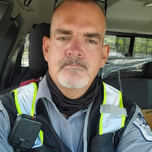


1 comment:
This is really Cool, I will be camping up in Moqui this week and this trail runs practically right through our campsite
Post a Comment